

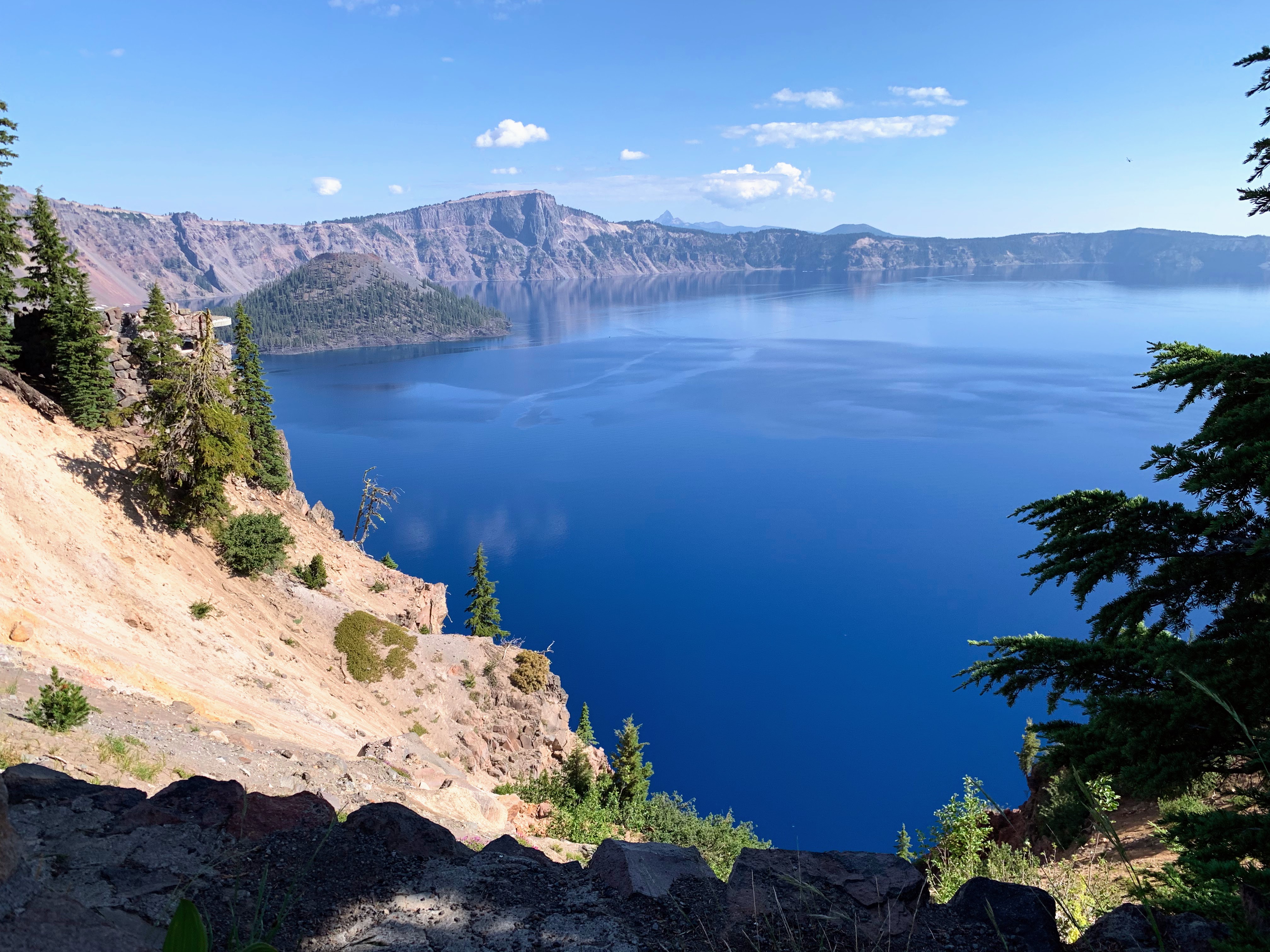
When I decided to go to Oregon, I knew there were two places I absolutely had to see: the coast and Crater Lake National Park.
Crater Lake is out of this world. Formed nearly 8,000 years ago when Mt. Mazama erupted, the lake is the deepest in the United States and one of the deepest in the world. The peak of the mountain is still visible above the water: it is called Wizard Island and you can actually hike to the basin!
The lake itself is pristine, an endlessly deep blue from thousands of years of collecting snowmelt and rainwater. It is icy to the touch and crystalline: you can see legions beneath you while you swim. It is, in short, one of my favorite places I’ve ever visited – in or out of the van.

Crater Lake National Park is not large or heavily visited: it spans just over 260 miles in the southern Cascades and has an annual visitation of around half a million (Yosemite, in comparison, covers 1,200 miles and attracts nearly 3 million people each year.) But all of this made me love the park even more, for its lack of crowds and ease of navigation.
My original plan was to spend a weekend here, exploring the trails and swimming in the lake. But summer season is fire season in this part of the country, and the weather had other plans. Saturday dawned, humid and smokey. My weather app gave me an alert I’d never seen, a Red Flag Warning, which means that “critical fire conditions are occuring…and can contribute to extreme fire behavior.”
And indeed, the radar showed a major thunderstorm sitting over the park, and the air smelled like a bonfire. So I stayed put at my boondocking site, keeping a careful watch for any new smells of smoke. Sunday dawned with clear skies and I was up early to get to the park. As with many national parks, the park boundaries are far before the entrance station, which was still closed when I drove through at 7:45 am. I have a National Parks pass to gain entry to any NP in the country: the entrance fee is otherwise $30 per vehicle.
If you only have a day to spend at Crater Lake, here are the two hikes you absolutely need to do.
Garfield Peak
My first stop of the day was in the Rim Village parking lot, between the visitor center and the Crater Lake Lodge, the park’s hotel. Here I was treated to my first views of the lake: a smooth pool of impossible blue sitting at the base of steep cliffs. I made my breakfast here and took the dog out for a walk (dogs aren’t allowed on most trails in any National Park.)
Then it was time for my first hike: Garfield Peak. The Rim Village parking lot is near the trailhead and you walk down an easy paved (but sloped) pathway along the lake to get there. The hike up Garfield Peak is around 3.5 miles out and back. It’s short but strenuous – with over 1,000 ft of elevation gain in the 1.7 miles to the peak. Still, it’s well worth the effort.
The peak doesn’t have the best views of the lake (that comes early in the hike at a dirt landing) but the time you spend on the trail gives you a panoramic view of the lake and the surrounding area. It was the perfect way to start my day in Crater Lake, pausing every few minutes in awe of this beauty. The color of the water, the grade of the slope of the cliffs – all of it seems impossible and yet is, right before your eyes.
I smoked a joint after summitting on a wooden bench. Summits tend to be a terrible place to smoke, with complete exposure to the wind. Instead, I settled back, enjoyed the view, and refueled myself for the way down. It was faster down than up, as the trail is rocky but easily navigable.
Garfield Peak is one of the most popular trails in the park as you don’t have to go far to get incredible views of the lake. It’s not a highly technical trail either, and you can turn around at any point and still enjoy yourself.
Cleetwood Cove Trail
My second stop for the day was the immensely popular Cleetwod Cove Trail, even more heavily trafficked than Garfield Peak. Cleetwood Cove is a 2-mile, out-and-back trail that throws you down the side of the cliff to the shores of Crater Lake. It’s an elevation loss (and then gain) of 700 feet, and the trail is quite steep in places. (The parking lot for this trail carries the same name.)
If you don’t mind a bit of rock scrambling, you can hop right into the lake when you arrive. Make no mistake – Crater Lake is cold – there were still patches of snow in certain areas even in August! The depths of the crater and the way the lake is fed through snowfall contribute to freezing temps year-round. I couldn’t resist hopping in, no matter how cold it was (and it was cold! But not the coldest plunge I’ve done this year.)
My only regret for this hike was not bringing goggles. The clear water means you can see right down into the stunning depths, and I would have loved to float around, staring down into the abyss. My husband and I swam for 20 or so minutes before the water started to turn our legs to ice. The trek out was far harder than the trek down, and I wished I could jump in the lake again when I got back to the parking lot.

On my way out of the park, I saw not one, not two, but three new fires starting across the hills that would turn into the Middle Fork fire. Rather than stay for another day of exploration, I headed across the state to the coast where fires are less of a regular occurrence.
While I didn’t enjoy most of my time in Eastern Oregon, I cannot recommend Crater Lake National Park highly enough. It’s one of those places that simply doesn’t feel real. There are no words to adequately describe its beauty and it’s easy to see why this place, called Giiwas, was a sacred site to the Modoc and Klamath Tribes. (Crater Lake National Park, like many others, was taken from tribal control against treaty.) If you have the chance to visit Crater Lake, even for as short of a time as I did, you will leave changed for it.


